Overview
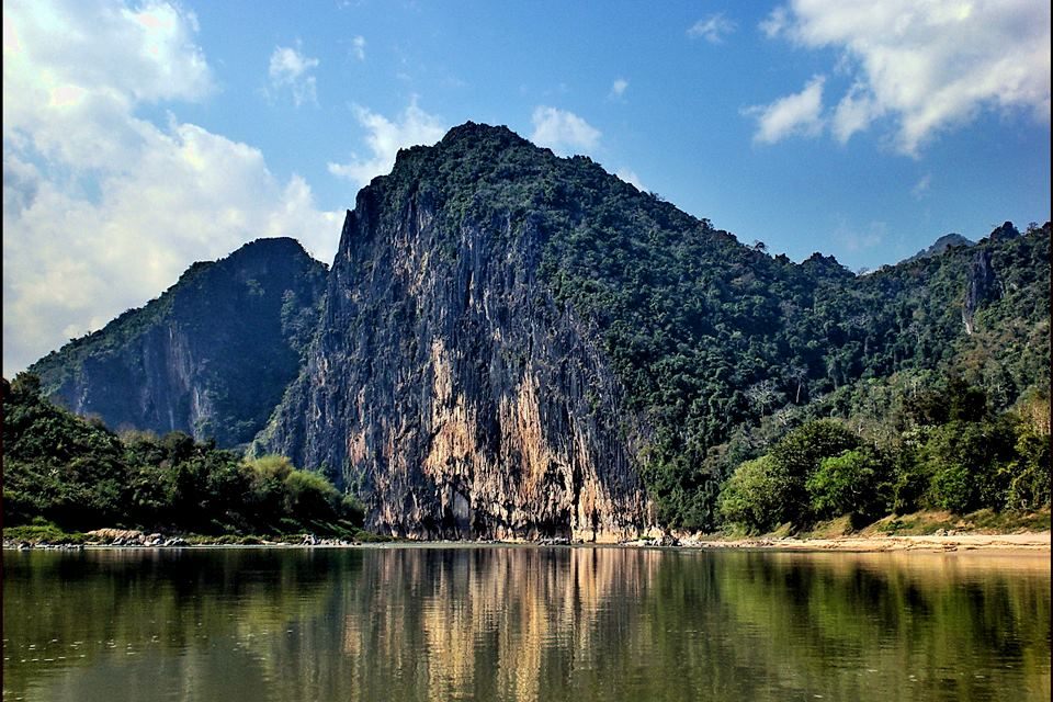
The Nam Ou is one of the most important rivers of Laos. It runs 448 km from Phongsaly Province to Luang Prabang Province. The river rises in Muang Ou Nua, near the Lao-Chinese border and traverses the northern Laos mountains and gorges until meeting

Description
The Nam Ou River reflects nationalism in Laos. Historically what is presently know as LuangPrabang, originates from a group of minorities who immigrated from Nan China along the Nam Ou river.
Chansamal Khouakham, an officer from the department of information and Culture in Moung Gnot Ou district, who was present when marking the boundary line between Laos-China, started that Nam Ou river begins from the hill foot of Phou Khoud mountain (close to the 5th boder sign on the slope of the mountain) with a height of 1245 meters which forms a natural boundary line between Laos and China. With a radius of about 25 meters the ponds creating the source of Nam Ou river is ina flat area surrounded by white sand and gravel. Dense grass along with huge soft wood such as; Ton Thong and Ton Toum Tam grow tall where the water is shallow to the ankle. From this point Nam Ou river curves downward 10 km reaching 7th boder sign at Lan Tui, the boundary line between Laos-China. At this point with a width of 2-3 meters wide, Nam Ou current becomes powerful and swiftly runs through the rain forest of Phou Fa mountain strongly to the mouth of Nam Ou river. Nam Ou river, wit a toal length of 488 km is the longest tributary of the Mekong river. Besides the Nam Ou river, Phou Khoud mountain creates 3 additional rivers in Laos; Nam Xang, Nam Ou Noy and Nam Khang river. In China, Phou Khoud mountain is the source of another river.
Muang La, Louangphabang
Laos
URL:
http://vietlongtravel.com/news/laos-travel-guide/nam-ou-river