Overview
Kamiyaku was a town located in the northern half of Yakushima in Kumage District, Kagoshima Prefecture, Japan. As of 2003, the town had an estimated population of 6,903 and a density of 23.09 persons per km². The total area was 298.95 km².
Description
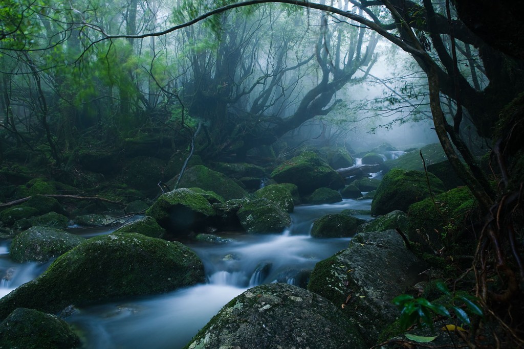
Yakushima is a round island floating above Kuroshio and is located about 130 km south of Kagoshima city as a detached island in Kagoshima prefecture. The island has an area of 504.86 km2, and it is the sixth-largest remote island after Sado Island, Amami-Oshima Island, Tsushima Island, Awaji Island, and Amakusa Shimoshima Island. Tanegashima Island is in the seventh position after Yakushima, with a total area of 444.94 km2. Yakushima can be reached within 30 minutes by plane from Kagoshima Airport, in 1 hour 50 minutes by high-speed ferry from Kagoshima Port or 3.5 hours by ferry from Yakushima 2 Kagoshima Port.
Yakushima is about 132 km in circumference, 504.86 km2 in area, with a population of 14,000 people. In the center of the island, there are about 300 mountains, including Kyushu's highest peak, Mt. Miyanoura (1,935 m). Yakushima is cut in half horizontally, with Kamiyaku Town to the north, and Yaku Town to the south and small settlements are dotted around the island. By the way, Kuchinoerabujima is also a part of Kamiyaku Town. Tashiro Annex is located at Miyanoura, the gateway to Yakushima.
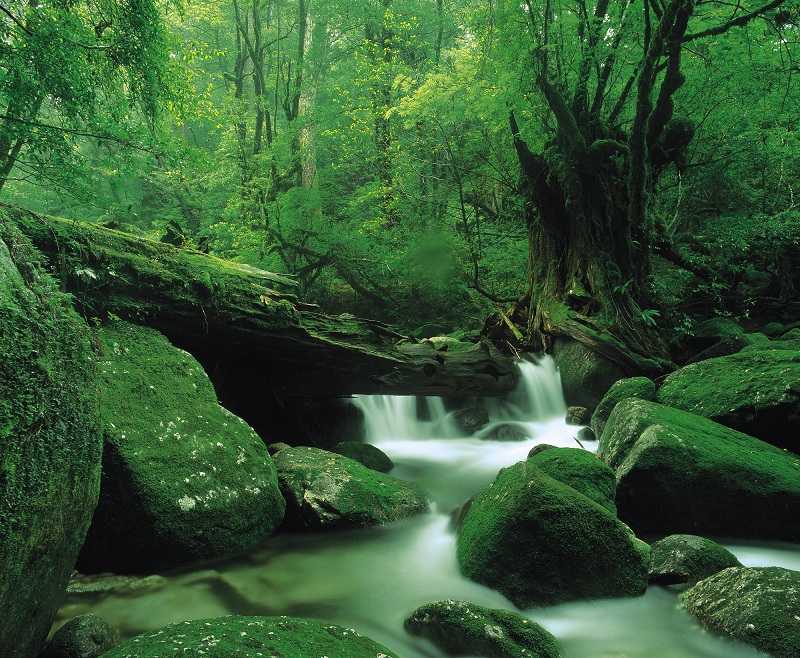
There are 3,500 people living in Miyanoura. The distance from Miyanoura Port to our hotel is about 2 km (30 minutes on foot or 4.5 minutes by car). It can also be reached in 15 minutes by car from Yakushima Airport in Koseda. Tashiro Annex is located in the upper part of the Miyanoura River at the Tosenkyo Bridge.