Overview
The Chico River, is a river system in the Philippines in the island of Luzon, encompassing the regions of Cordillera and Cagayan Valley. It is the longest tributary of Cagayan River with a total length of 233 km.

Description
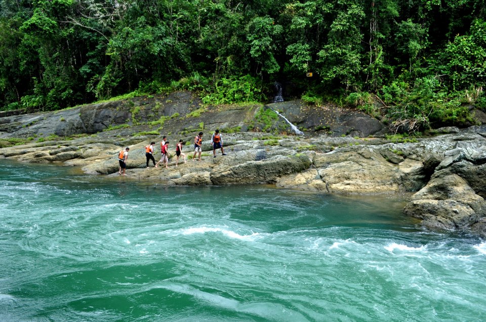
The Chico River is the lifeblood of the Cordillera region. It emerges from the slopes of Mount Data and flows northeast towards the Pacific, winding through the country’s biggest mountain range and sustaining its plants, animals and people. Though only a ribbon amid the immensity of the Cordillera, the Chico River is central to the life of the region's people and environment. Vegetables grow in terraces in the river's surrounding mountains, villagers fish in the water and forests thrive just beyond the riverbanks.
Over 170 kilometers long the Chico River's character changes dramatically from source to sea. The upper river in the Mountain Province is the narrowest section and goes through gorges with steep rock walls. As the Chico flows into Kalinga it widens slightly and gorges are replaced by towering mountains and lush rainforests. The upper and middle sections have the most challenging rapids, with consecutive class IIIs and several class IVs. When the Chico nears the great Cagayan River the mountains fall away and serene plains take their place. This lower section is wide and relatively mellow but several exciting class IIIs keep paddlers on the edge of their raft.
The Chico River flows through the Mountain Province and Kalinga which are the more inaccessible and lesser known areas of the Cordillera. These provinces have all the charm and beauty of their famous neighbor Banaue in the Ifugao Province but they have far fewer tourists. On this adventure we go deep into the mountains to visit remote villages: Maligcong and its awe-inspiring rice terraces, Buscalan and its traditional tattoo artists and Tulgao with its waterfall and hot spring.
Tabuk Kalinga-Apayao
Philippines
URL:
http://www.unchartedphilippines.com/en/adventures/chico-river-rafting-adventure-mountain-province-and-kalinga/